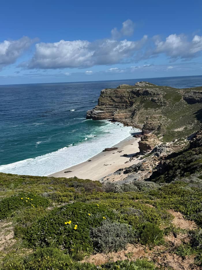
Cliff view
The lighthouse
Upper funicular station
Book the dayGuides
Language
Currency
See open slotsfrom $44 · no cancel feeLocate your stop
Summary
The Cape of Good Hope and Cape Point are separate stops in one reserve, with the lighthouses at Cape Point and the famous signboards at the Cape of Good Hope.
Telling them apart
See all 16 stops
Select a route, then tap a marker or stop to see its note and open Google Maps.
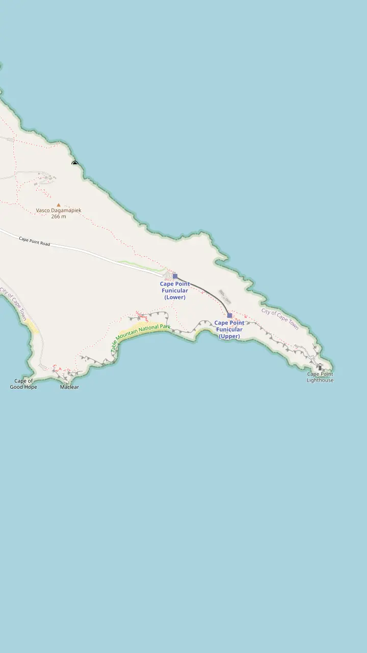
The walk from the main parking area to the Cape of Good Hope sign is 3.5 km.
Google MapsThe beach lies down a steep wooden staircase.
Google MapsThe funicular ride takes 3 minutes from the lower station.
Google MapsThe Lighthouse Keeper's Trail begins behind the upper funicular station and leads to the new lighthouse.
Google Maps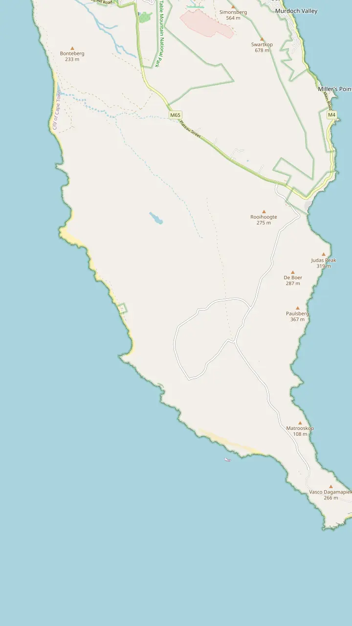
Buffels Bay has tidal pools, swimming spots, picnic sites and walks.
Google MapsFrom Olifantsbos Point visitors look toward where the Lusitania hit Bellows Rock in 1911.
Google Maps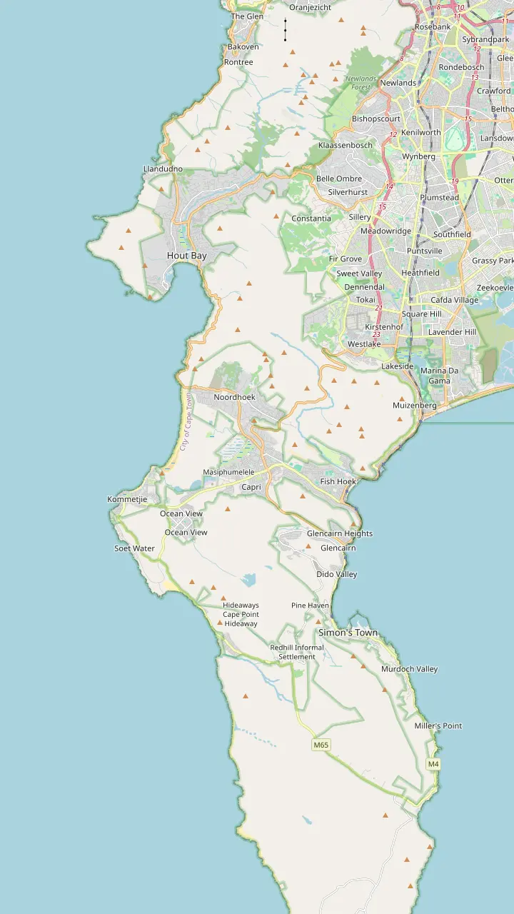
The drive is a 9km route with 114 curves.
Google MapsHout Bay has one of the most active fishing harbours in South Africa.
Google MapsHorse-riding on Noordhoek Beach is one of the most popular activities there.
Google MapsThe Atlantic route follows the coast through Kommetjie on its way to the reserve.
Google MapsThe False Bay route follows the M3 to Claremont, then Muizenberg, Fish Hoek and Simon's Town.
Google MapsSimon's Town is 35 km from Cape Town.
Google MapsThe Boulders colony is estimated at 2,000 to 3,000 birds.
Google Maps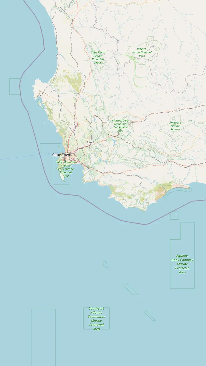
Cape Point is just 60 km from Cape Town.
Google MapsCape Agulhas, the southernmost tip of Africa, lies about 220 km south-east of the peninsula.
Google MapsSimon's Town is 35 km and Cape Point 60 km from Cape Town.
Google Maps© OpenStreetMap contributors · map data
They share a reserve, a gate and a road, yet they are different places with different views. Here is where each one is, how the names arose and which one you want.
Editorial team, capepointtour.top · Updated November 7, 2026 · Allow 8 min
Overview
The Cape of Good Hope and Cape Point both sit at the far end of the Cape Peninsula, south of Cape Town. The reserve that covers it is one park, with one gate and one road in, and it sits in the southern section of Table Mountain National Park.5 The names are often used as if they were one. Inside it the names belong to different spots, a short drive and a longer walk apart, and that is where the confusion starts.
Cape Point is the high, rocky headland with the lighthouses on it. The Cape of Good Hope is the low rocky shore on the western side, where the famous signboards stand. The reserve's own description makes the layout plain: Cape Point is made up of 3 promontories: the Cape of Good Hope, Cape Maclear and the point itself.6 So the Cape of Good Hope is part of Cape Point in the tourism sense, while Cape Point is only one of its parts on the map, however large it looms in the marketing.
That also answers where the Cape of Good Hope is: at the end of the same road, in the same reserve. Both lie close to the city by the standards of a famous cape. Wesgro, the Western Cape's tourism and investment agency, puts Cape Point just 60 km from Cape Town.7 That makes the pair a natural day out of the city, and it is why a single listing can reach both of them, plus the penguins, in one long day. The rest of this page separates the names, so you know which one a photograph or a walk belongs to.
Side by side
| Question | Cape Point | Cape of Good Hope |
|---|---|---|
| What you see | Cliffs and the old lighthouse10 | Signboards on a rocky shore14 |
| How you reach it | Funicular, 3 minutes13 | Boardwalk, about 3.5 km15 |
| Walking time | The funicular spares the climb1 | 2 to 3 hours return15 |
| Described as | A physical meeting of currents4 | Most southwesterly point of the continent16 |
| On our day tour | 45 minutes at the new lighthouse | 30 minutes at the Cape of Good Hope |
Both stops sit in the same reserve, so the same gate and the same opening hours apply.18
Start with Cape Point. The reserve's operator says the old lighthouse dates from 1859 and stands on Da Gama Peak, the high point of Cape Point, at 238 m above sea level.10 The funicular lower station stands 127 m above sea level, and the ride up takes 3 minutes.12,13 That is the part of the reserve with the cliffs, the lighthouse views and the restaurant, and the lighthouse is what the name Cape Point usually brings to mind.
Now the Cape of Good Hope. The operator's walking guide describes a marked boardwalk that leads to the famous Cape of Good Hope sign on the rocky shoreline far below.14 The same guide gives the trail as about 3.5 km and 2 to 3 hours return, rated easy.15 South African Tourism's own listing agrees on the distance, putting the walk from the main parking area to the sign at 3.5 km.2 This is the low, windy, rocky corner, and it is the sign that people queue to pose beside.
So these are different stops with different views. From the lighthouse you look down on the sea and along the coast, and from the sign you stand at the water's edge with the cliffs above you. The tourism pages call the Cape of Good Hope the most southwesterly point of the African continent, and the operator's walking guide calls the end of its trail the most southern point of the Cape Peninsula.16,17 Both phrases are about the peninsula and the continent's corner, which brings us to the next question.
The older name is the harsher one. The operator says the Portuguese navigator Bartolomeu Dias rounded the Cape Peninsula in 1488, earlier than anyone else, and that he called it the Cape of Storms after its notoriously bad weather, which can blow up quickly.8 Sailors treated the point with respect for centuries, and after dark or in fog it was a real hazard.21 The reserve still counts 26 recorded shipwrecks around the point, so the warning in the name Cape of Storms was earned.22
The kinder name came later. According to the same history, King John II of Portugal gave it the name Cape of Good Hope, reflecting the optimism that the new sea route to India and the East inspired.9 So one place carried a warning in one century and a promise in another, and both names survived in everyday use. That is a large part of why visitors cannot decide which to type into a search box.
You can still see the history on the ground. The reserve's visitor page lists memorials to Vasco da Gama and Bartolomeu Dias among the cultural and historical sights worth looking for.23 If the old names appeal to you, the audio tour the operator offers is free to download before you go, and it is worth doing at home, since the mobile signal in the park is limited.24 A little context makes the windswept signboard feel less like a photo stop and more like the end of a long story about ships, storms and trade routes.
Pick your stop
Say what you are after and see which part of the reserve fits.
If The lighthouse on its cliff
Cape Point
The funicular runs from the car park up to the upper lighthouse.20
If The famous signboard
Cape of Good Hope
The marked boardwalk leads down to it on the shoreline.14
If The southern tip of Africa
Cape Agulhas
It lies about 220 km south-east of the peninsula.3
If A walk with little effort
The funicular
It spares visitors the climb from the car park.1
If A long easy walk to the water
The boardwalk
The trail is about 3.5 km and rated easy.15
Places to stand
Cliff view
Upper funicular station
Book the day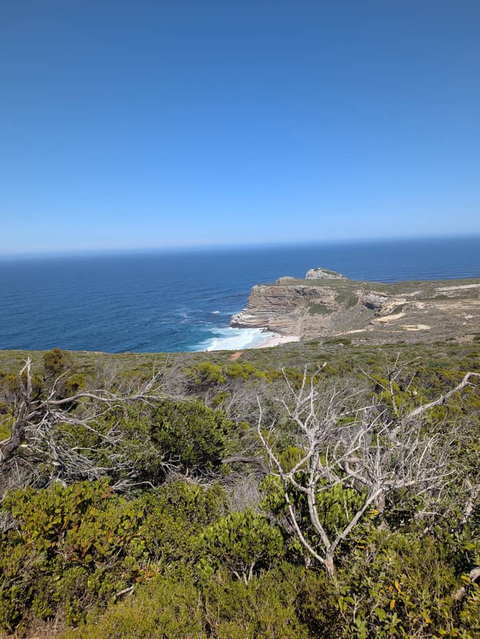
The photo
Cape of Good Hope
Book the day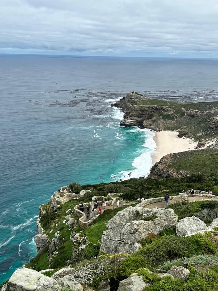
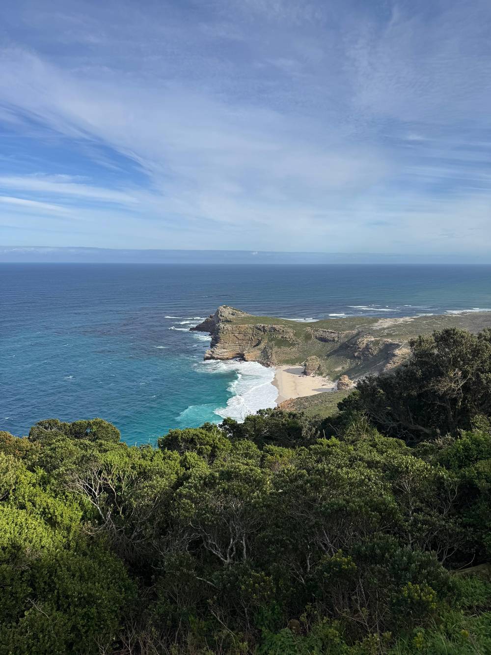
Quiet frame
Dias Beach
Book the dayThis is the part that surprises people. South African Tourism states plainly that Cape Point is not, as many believe, the most southerly tip of Africa.39 That tip is Cape Agulhas, which the same body places about 220 km south-east of the peninsula, at the longitude where the Indian and Atlantic oceans are said to meet.3 The Cape of Good Hope is famous, but it does not mark the bottom of the continent.
The meeting of the oceans is the other myth worth correcting. The reserve operator's own article gives Cape Agulhas the title of official dividing line, while Cape Point is where the strong Benguela and Agulhas currents actually collide.4 South African Tourism says much the same: the oceans have no respect for cartographers, and their contrasting currents meet off Cape Point.40 So both claims are partly true, depending on whether you mean a line on a map or a mixing of water.
That distinction is useful at the sign. You can enjoy the Cape of Good Hope for what it is, a dramatic headland with a long history, and a corner of the continent that tourism pages describe as its southwestern edge. You do not need it to be the end of Africa to be worth the trip. If a guide on your day says something grander, you will now know which part is folklore, and you can ask which reading the guide means when the word meeting comes up.
A short history
1488
He names it the Cape of Storms for its notoriously bad weather.8
After Dias
The name Cape of Good Hope came from hope for the new sea route to India.9
1859
It stands on Da Gama Peak, 238 m above the sea.10
Later
The first one was too often hidden in mist, so one was built at 87 m.10
1914
Its beam is the strongest on the South African coast.11
Choose by the picture in your head. If you want the lighthouse perched on a cliff above the sea, you want Cape Point, and the funicular puts you at the upper station for the view.1 The track starts at a lower station by the car park and climbs through thick fynbos to the upper lighthouse, and a car leaves the lower station every 3 minutes.20,19 That is the postcard at the head of every Cape Point page.
If you want the signboard, you want the Cape of Good Hope, which means the boardwalk and a longer walk. The 3.5 km trail is described as easy, and the guide's own advice is to go all the way to the end for the photograph that proves you have been there.15,17 There is a separate Cape Point sign near the viewpoints as well, so check which board you are standing beside before you share the picture, because the boards say different things.
A third option is the beach below. The operator mentions views over Dias Beach as a reason to take the boardwalk.14 You do not need the sign to enjoy the cove, which is wild and open, and it makes a calmer frame than a queue at the board. Go early if you can: the Cape of Good Hope gate typically opens at sunrise and closes at sunset, and a visit at the quiet end of the day suits a long walk.18
Video
Alt Living with Steve and Naz on YouTube · Your tap on play is what loads the video.
While Cape Agulhas is the official geographical boundary, Cape Point is the physical site where the powerful Benguela and Agulhas currents meet.
Before you go
The old debate of Cape Point against the Cape of Good Hope is one a day tour never forces you to settle. A day tour does not make you choose. Our listing, the 10-hour Cape Point and Boulders Beach tour, stops at the Cape of Good Hope for 30 minutes and the new Cape Point lighthouse for 45 minutes, among its other stops. That is enough for the signboards and the cliff views, though not for the full 3.5 km boardwalk to the water.15 Treat the stops as a taster of both names rather than a deep walk, and ask your guide at the start where the time will go.
What the day does buy is time. The listing describes buying a funicular ticket or taking a 15-minute walk up to the lighthouse, and the hotel pickup, the guide's overview of the reserve and the long drive are all handled for you. Rated 4.8 across 3,399 reviews, it books from $44, and it can be cancelled free up to 24 hours before. The reserve's own fees are a separate matter, covered on our fee page.
If you would rather see both properly, you have a choice of how to build the day. A self-drive visit or a private tour lets you give the boardwalk a long stretch, while the group tour gives you the sights in a single sweep. Either way, you now know the sign and the lighthouse are different stops. Read the map above, pick the ones you care about, and tell your guide at the start of the day.
FAQ
Cape Point is one of 3 promontories in the reserve, and the Cape of Good Hope is another.6
Agulhas is the official boundary, while the currents physically meet off Cape Point.4
That is Wesgro's figure for the distance from the city to the reserve.7
The operator's walking guide gives the trail as 2 to 3 hours return and rates it as easy.15
King John II renamed Dias's Cape of Storms after the sea route to India opened.9
The 10-hour tour stops at both the Cape of Good Hope and the lighthouse.
Sources
Next read
Planning a day at Cape Point? A real person answers here.