Easy
Lighthouse path
From the upper station
See the day tourGuides
Language
Currency
See open slotsfrom $44 · no cancel feeLocate your stop
Summary
The main Cape Point trails are the Lighthouse Keeper's Trail at about 2 km and 1 hour return, and the Cape of Good Hope trail at about 3.5 km and 2 to 3 hours return.
The two main walks
See all 16 stops
Select a route, then tap a marker or stop to see its note and open Google Maps.
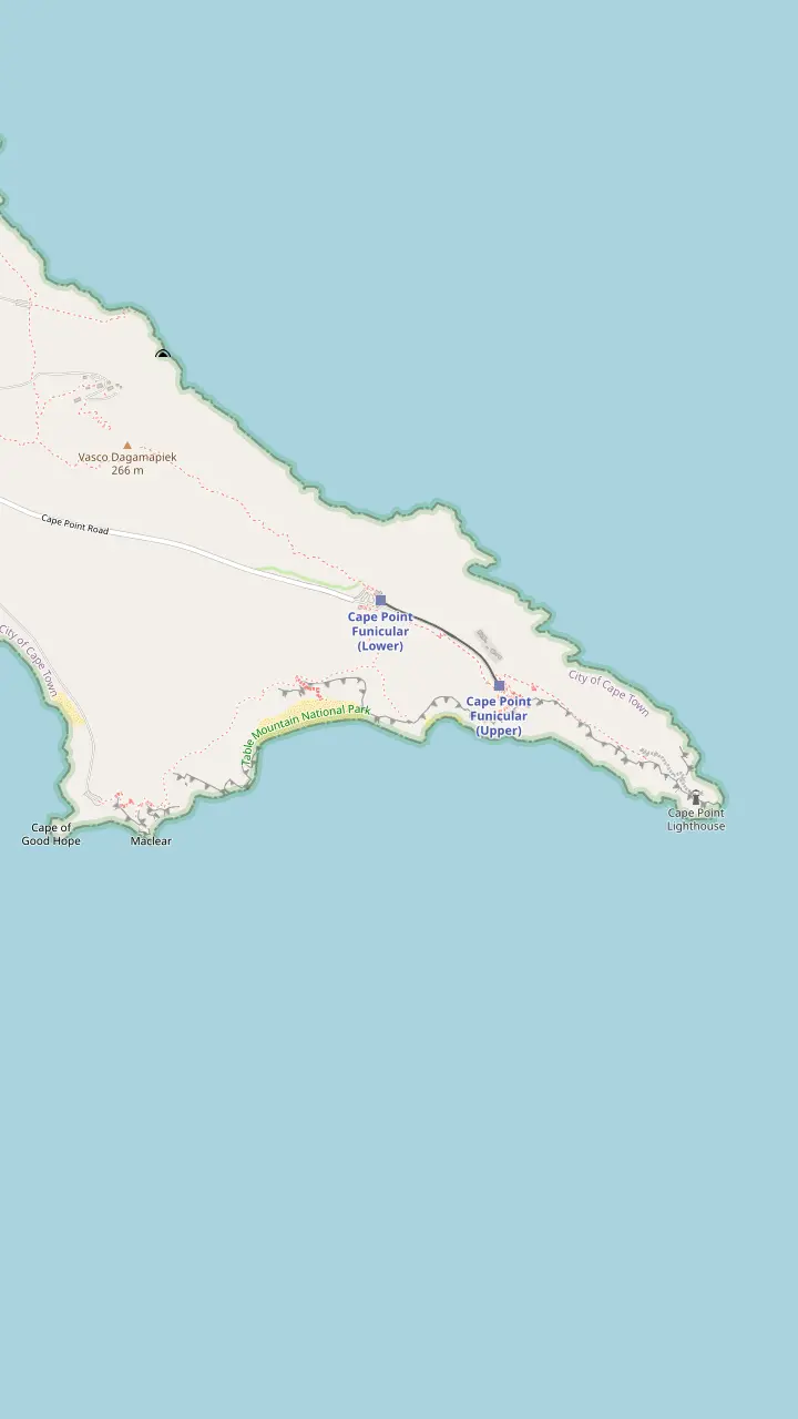
The walk from the main parking area to the Cape of Good Hope sign is 3.5 km.
Google MapsThe beach lies down a steep wooden staircase.
Google MapsThe funicular ride takes 3 minutes from the lower station.
Google MapsThe Lighthouse Keeper's Trail begins behind the upper funicular station and leads to the new lighthouse.
Google Maps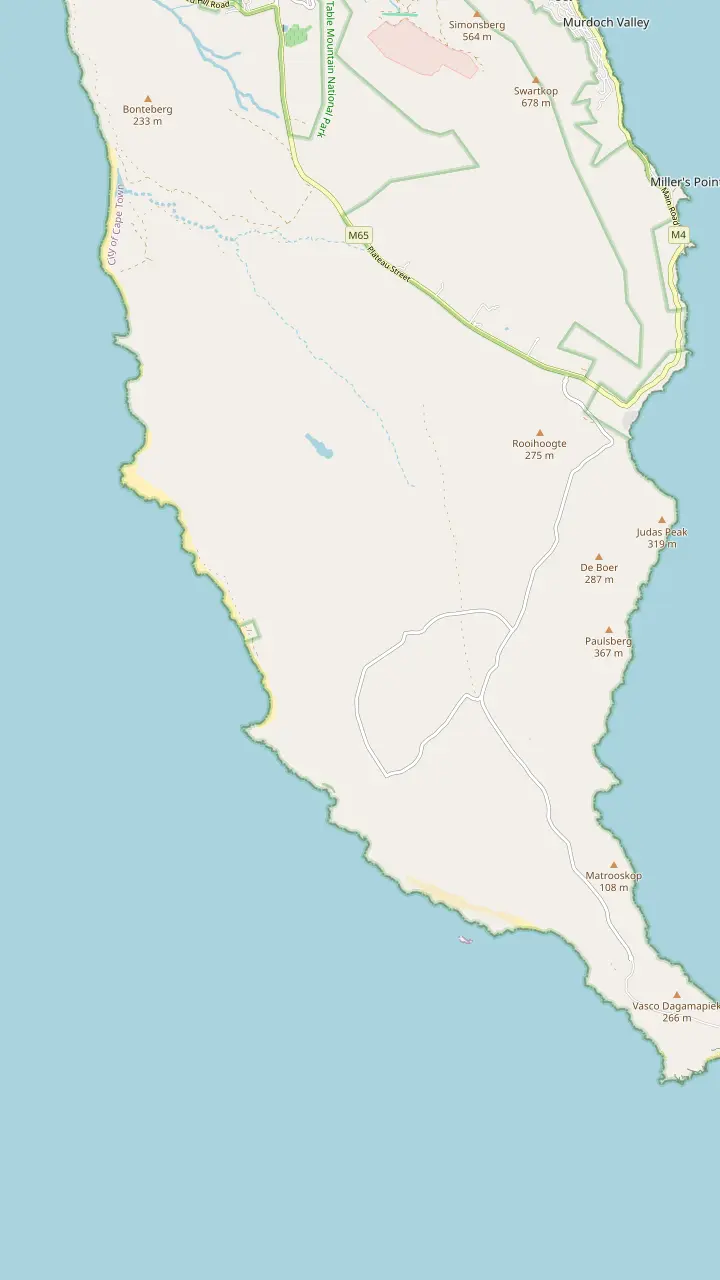
Buffels Bay has tidal pools, swimming spots, picnic sites and walks.
Google MapsFrom Olifantsbos Point visitors look toward where the Lusitania hit Bellows Rock in 1911.
Google Maps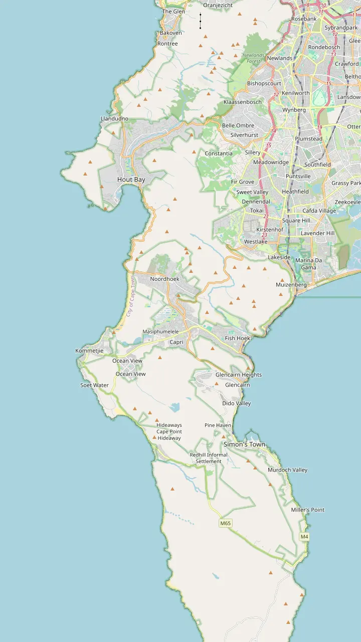
The drive is a 9km route with 114 curves.
Google MapsHout Bay has one of the most active fishing harbours in South Africa.
Google MapsHorse-riding on Noordhoek Beach is one of the most popular activities there.
Google MapsThe Atlantic route follows the coast through Kommetjie on its way to the reserve.
Google MapsThe False Bay route follows the M3 to Claremont, then Muizenberg, Fish Hoek and Simon's Town.
Google MapsSimon's Town is 35 km from Cape Town.
Google MapsThe Boulders colony is estimated at 2,000 to 3,000 birds.
Google Maps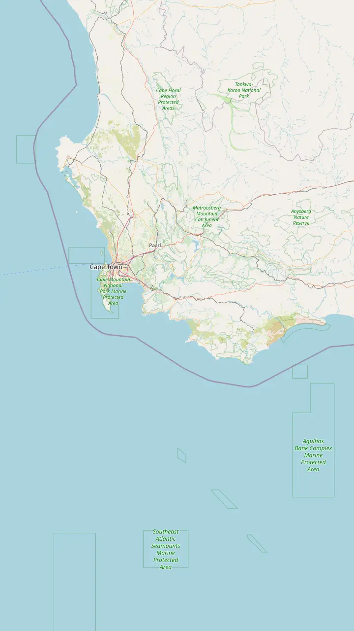
Cape Point is just 60 km from Cape Town.
Google MapsCape Agulhas, the southernmost tip of Africa, lies about 220 km south-east of the peninsula.
Google MapsSimon's Town is 35 km and Cape Point 60 km from Cape Town.
Google Maps© OpenStreetMap contributors · map data
A guide to the walks at Cape Point, from the lighthouse path to the Cape of Good Hope boardwalk, Dias Beach and the shipwreck route, with lengths, times and path rules.
Editorial team, capepointtour.top · Updated November 7, 2026 · Allow 6 min
Overview
Cape Point walks suit a short stop, and the reserve lends itself to them, and the operator's visitor page also speaks of a wide variety of scenic and overnight trails through fynbos and along sandy beaches, so a hiker with spare days has more to choose from.7 Cape Town Tourism names the Cape of Good Hope Trail, the Lighthouse Keeper's Trail and the Shipwreck Trail as the walks to try.8 This page sorts those into the ones that fit around a single visit.
The reserve covers approximately 7,750 hectares, and its coastline is 40 km long.9,10 If you are on a guided day, remember that the stops are timed. The listing gives the Cape of Good Hope 30 minutes and the new Cape Point lighthouse 45 minutes, and a guest who wants more than a photograph at either has to choose carefully.
The listing also gives guests a choice at the lighthouse: buy a ticket for the funicular, or take a 15-minute walk up. The funicular ride is 3 minutes, so the walk suits anybody with spare minutes and good shoes.11 Everything below assumes you have the time of a short visit and want to use it well.
Walk by walk
| Walk | Length and time | Starts at | Good to know |
|---|---|---|---|
| Lighthouse Keeper's Trail | About 2 km, 1 hour return1 | Behind the upper funicular station13 | Rated easy1 |
| Cape of Good Hope trail | About 3.5 km, 2 to 3 hours return2 | Main parking area18 | Marked boardwalk19 |
| Phyllisia route | 1.5 hours each way5 | Olifantsbos area20 | Lower trail 20 minutes longer21 |
| Dias Beach stairs | Short, steep descent3 | Above the beach3 | Swimming discouraged4 |
| Bay walks | Short and gentle22 | Buffels Bay and Bordjiesrif22 | Designated braai areas23 |
Lengths and times are the operator's own and apply to walkers on the signed routes.
The Lighthouse Keeper's Trail begins just behind the upper funicular station and leads to the new lighthouse.13 The operator rates it about 2 km, 1 hour return, and easy.1 It is the walk that most closely matches a normal sightseeing visit, because it starts where the funicular or the walk up from the car park ends.
The new lighthouse is built closer to the sea, and the original one was ineffective in mist.14,15 The old lighthouse is now a central monitoring point for all the lighthouses in South Africa.16 The path between them is a good place for photographs of the cliffs, with the old light above you and the sea far below.
Plan around the weather and the clock. The funicular and the gate follow set hours, and a walk of an hour return adds up when it follows a queue for the ticket office. Keep the Lighthouse Keeper's Trail for a clear spell, because a path with fog on the headland rewards you with a grey wall rather than a view, and the operator itself says the Point was a menace to ships in fog.17
Minutes on the headland
The funicular ride is 3 minutes and the optional walk up 15 minutes, while the tour record gives the Cape of Good Hope 30 minutes and the new lighthouse 45 minutes.11
The Cape of Good Hope trail is about 3.5 km, 2 to 3 hours return, and easy, according to the operator.2 It follows a marked boardwalk to the Cape of Good Hope sign on the rocky shoreline.19 Another official collective gives the walk from the main parking area to the sign as 3.5 km.18 Set aside a good part of the day if you want to walk it unhurried and take photographs.
The end of the trail is described as the most southern point of the Cape Peninsula, and the Cape of Good Hope as the most southwesterly point of the African continent.24,25 It is not the southernmost tip of Africa, which lies far to the east, so a photograph at the sign makes a better souvenir of the peninsula than of the continent.26
A more modest way to see the cape is to take the Cape of Good Hope stop on a day tour, where the listing gives it 30 minutes. That is enough for the sign and the immediate shoreline, but not for the whole trail. Anyone who wants the full boardwalk should arrive early or plan a separate visit.
Match your visit
Choose the line that sounds like your plan and read the answer beside it
If I have about an hour
Lighthouse Keeper's Trail
It is about 2 km, 1 hour return, and easy.1
If I want the famous sign
Cape of Good Hope trail
It follows a marked boardwalk to the sign on the shoreline.19
If I want wrecks and quiet
The Phyllisia route
It takes 1.5 hours each way from the Olifantsbos area.5
If I want a quiet beach seat
Dias Beach
It lies down a steep wooden staircase and swimming is discouraged.3,4
If I travel with children
Bay walks at Buffels Bay
Bordjiesrif and Buffels Bay have tidal pools and picnic sites.22
Pick your walk
Easy
From the upper station
See the day tour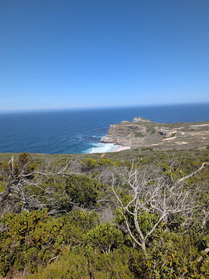
Easy
To the sign
See the day tour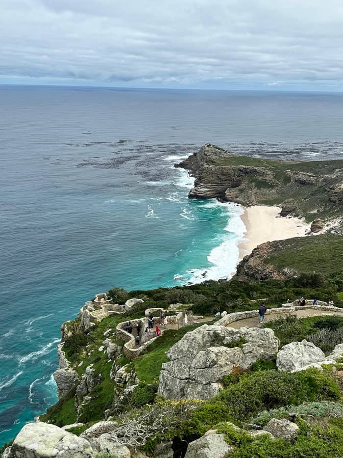
Longer
Kleinkommetjie Ridge
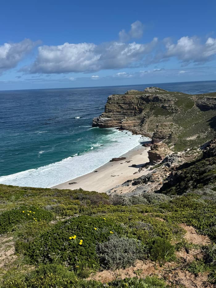
See the day tourDias Beach at Cape Point sits at the bottom of a steep wooden staircase, so the first thing to know is that the way back is uphill.3 Cape Town Tourism says swimming there is discouraged because the currents can be quite dangerous.4 Some searches spell it Diaz Beach, while the Cape Point pages write Dias Beach. It is a quiet beach to sit on and look at the water, and it is not a beach to plan a swim at.
Baboons are known to visit Dias Beach, so belongings should be watched.43 Take a small bag and zip it, carry water for the climb back, and leave lunches in the car. The wildlife page of this site gives the full baboon rules for the reserve.
The beach is a good short objective on a day with an hour to spare. It adds a different view of the coastline from the lighthouse side, and the staircase is a clear, signed route, which makes it easier than guessing at a path in the fynbos.
Price the day
Type your party size and compare four ways to reach the trails
Choose from 4 options
Type your party size and compare four ways to reach the trails
≈
View≈
View≈
View≈
ViewStarting prices on GetYourGuide, exchanged at the ECB reference rate. The booking page gives the exact price.
A morning on foot
Gate opens
The gate typically opens at sunrise, and from October to March it is open 6:00am to 6:00pm.12,6
Car park
The funicular ride takes 3 minutes, and the listing also offers a 15-minute walk up.11
Upper station
The Lighthouse Keeper's Trail is about 2 km, 1 hour return, and easy.1
Cape of Good Hope
The trail is about 3.5 km, 2 to 3 hours return, to the sign.2
Dias Beach
The beach lies down a steep wooden staircase, and swimming is discouraged.3,4
Before closing
Vehicles leaving after closing time are fined.12
The reserve's own visitor page describes a shipwreck trail that passes some of the 26 wrecks on record around Cape Point.44 From Olifantsbos Point, on the Atlantic side of the peninsula, visitors look toward where the Lusitania hit Bellows Rock in 1911.27 A stone cairn in the fynbos shows the way down to the beach.20
For a longer walk, the operator describes the Kleinkommetjie Ridge route to the remains of the steam trawler Phyllisia. It puts the walk at 1.5 hours in each direction.5 The lower hiking trail takes about 20 minutes longer.21 That makes it a long outing, so it suits a self-drive visit better than a guided day.
The Cape Point operator says the Cape coast is strewn with the remains of many wrecks, and some can still be seen around Cape Point.45 The wrecks are a good reason to walk slowly, since the shore is as interesting as the view out to sea.
Video
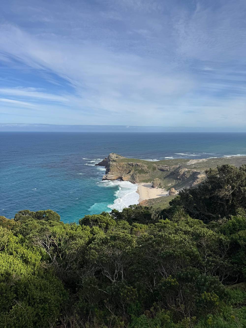
Inspired Living with Joao de Gois on YouTube · Your tap on play is what loads the video.
Hike along a wide variety of scenic and overnight trails through natural fynbos and along sandy beaches.
Before you walk
On the False Bay side, Bordjiesrif and Buffels Bay have tidal pools, swimming spots, picnic sites and walks.22 Cape Town Tourism recommends them for a more family-friendly beach experience than Dias Beach, and mentions the odd ostrich ambling past.46 Fires are limited to designated braai areas, among them those beaches.23
The easy walks around the bays suit a rest day or a late afternoon. They keep you close to the car, to toilets and to the picnic lawns, and they leave the long boardwalk for another day.
The site tour does not list these bays among its stops, so they belong to a self-drive visit or a private day with a flexible route. Cape Town Tourism's day guide advises comfortable walking shoes, sun protection, water and a jacket, which is the right kit for any of the False Bay paths.40
Cape Town Tourism asks walkers to wear decent shoes, follow trail signs and tread lightly, because fynbos is fragile.39 The operator asks visitors to stick to the designated boardwalks, because walking off-trail causes severe soil erosion.41 Visitors are also asked not to collect shells or stones.42
Check trail conditions before setting out, and expect patchy phone reception.37,38 The gate typically opens at sunrise and shuts at sunset, with fines for vehicles that leave late.12 From October to March the gate is open 6:00am to 6:00pm, and from April to September 7:00am to 5:00pm.6,47
A last point is the path itself. The Cape of Good Hope trail follows a boardwalk, the Lighthouse Keeper's Trail is rated easy, and the staircase to Dias Beach is steep.19,1,3 None of them needs equipment, but each rewards a hat, water and a layer for the wind, and the walk back is where you will be glad of them.
FAQ
The site's tour listing offers a 15-minute walk up as the choice to the funicular ticket.
Fires are limited to designated braai areas, among them Buffels Bay and Bordjiesrif.23
Cape Town Tourism advises comfortable walking shoes, sun protection, water and a jacket.40
Sources
Next read
Planning a day at Cape Point? A real person answers here.